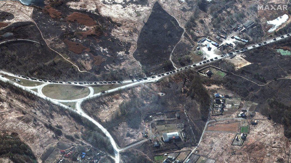
Ukraine crisis: Satellite data firm asks for war images
 Image source, MAXAR TECHNOLOGIES
Firms and space agencies that collect satellite imagery are being urged to share Ukraine and Eastern Europe data.
The plea comes from Ukrainian-based satellite data firm EOS Data Analytics (EOSDA).
It has said that it will put data suppliers in touch with Ukraine's deputy prime minister Mykhailo Fedorov.
EOSDA's founder Max Polyakov said that it would provide "actionable intelligence" to those resisting the Russian invasion.
He asked for "recent and real-time high-to-medium resolution optical and radar satellite imagery" to assist in both military and humanitarian efforts in the region.
"The economic, political, and humanitarian consequences of the war in Ukraine are already too high to stand on the sidelines," he said in a statement.
There are two main types of satellite imagery.
SAR (Synthetic Aperture Radar) bounces a microwave radar signals off the Earth's surface to detect physical properties. It can be used to capture and track small-scale movements on the surface of the Earth - so would be able to detect troop movements, for instance. It can work in all weather types and at night.
Firms that provide this include Capella, Iceye, Airbus and Spacety.
Optical imagery, from companies such as Maxar Technologies and Planet, is also being asked for, although the satellites which provide it rely on visible or infrared light, so can't see through clouds and are not as effective at night.
Some firms are already sharing their imagery. Planet recently launched a specialised, non-public platform that is monitoring hundreds of satellite feeds over Ukraine. It has daily images with high resolution, and uses algorithms to detect in real-time, activity such as traffic congestion and the movements of ships and plans.
And Maxar's Earth Constellation is providing images to news outlets and bloggers.
Dark side
"Publicly available satellite images are a defining feature of 21st century warfare," Robert Muggah, principal of satellite and mapping firm SecDev Group, told the BBC.
"Satellite maps shared in conventional and social media can offer tremendous insight at lightning speed but also generate dangerous liabilities, especially when it comes to prospective military and civilian targets."
But he added there is a "dark side".
"Not only can geospatial information be leverage and manipulated by military actors, geospatial misinformation and disinformation are also potential risks".
Satellite images can also be doctored, with deep fakes or simple photoshopping a "growing concern," he said.
Google recently announced that it is removing from Maps any user-submitted locations in Russia, Ukraine and Belarus to avoid user-generated pins being linked to missile strikes.


No comments